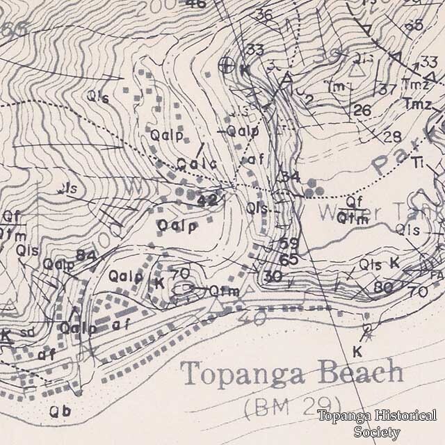
Geological map of Topanga Beach shows fault lines, 1973
Title
Geological map of Topanga Beach shows fault lines, 1973
Description
Preliminary geologic map of the unincorporated part of the Topanga quadrangle, Los Angeles Country, California.
Date
1973
Source
O Maps
Rights
Materials in this collection may be protected by the U.S. Copyright Law (Title 17, U.S.C.). In addition, the reproduction of some materials may be restricted by terms of Topanga Historical Society gift or purchase agreements, donor restrictions, privacy and publicity rights, licensing and trademarks. Transmission or reproduction of materials protected by copyright beyond that allowed by fair use requires the written permission of the copyright owners. Works not in the public domain cannot be commercially exploited without permission of the copyright owner. Responsibility for any use rests exclusively with the user.
Creator
R. F. Yerkes, R. H. Campbell, J. E. Schoellhamer, P. W. Birkeland
Contributor
Resource Conservation District
←Next Item
Previous Item→
Previous Item→
Collection
Citation
R. F. Yerkes, R. H. Campbell, J. E. Schoellhamer, P. W. Birkeland, “Geological map of Topanga Beach shows fault lines, 1973,” Topanga Historical Society Digital Archive, accessed April 28, 2024, https://www.topangahistoricalsociety.org/archive/document/1659.
